
See where cut and fill are concentrated, how the site changes across the grading plan and where earthwork conditions may deserve closer review.

Earthwork productivity depends on how material is distributed across the site. Concentrated excavation, shallow widespread cuts, isolated deep fills and long internal hauls can produce very different operating conditions even when the total cubic yards are similar.
Our 3D analysis is intended to make those differences easier to see during estimating and project review.
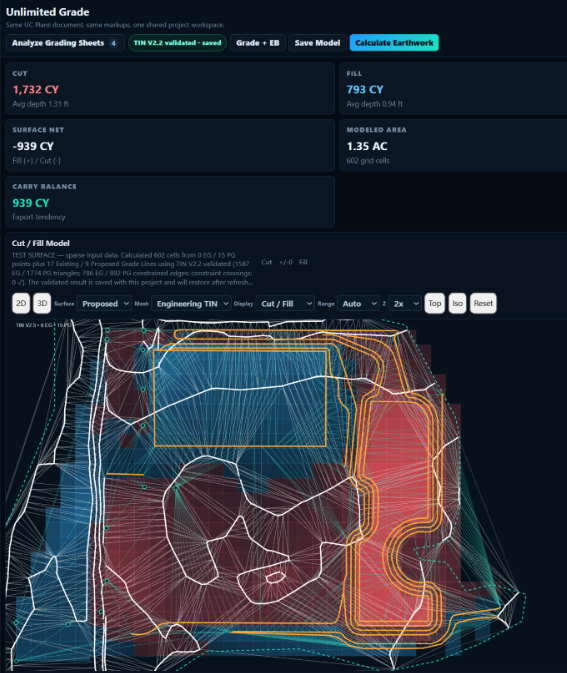
The model is not a substitute for engineering documents or survey control. It is an estimating and visualization tool that helps our team and the contractor interpret the grading scope.
Identify where major earthwork volumes are concentrated instead of relying only on a project total.
Support import/export discussions and locate areas that may drive internal haul or stockpile strategy.
Consider whether scrapers, excavators, loaders, trucks or other equipment better fit the grading pattern.
Review how haul distance, access and distribution of work may affect expected daily production.
Call attention to deep excavation, large fills, abrupt transitions and other areas worth additional review.
Provide estimators, project managers and clients with a more intuitive visual explanation of the grading scope.

Our team understands scraper haul, excavator loading, truck cycles, grader finish work and the effect site access has on production. The value of visualization comes from connecting the model to those real operating conditions.
Request 3D analysis